
- Lodging
- Adventures
- Food
- Culture
Lodging
I stayed in an Airbnb in Kanab, UT with a wonderful host, Charlotte. Kanab is incredibly cost effective! My room averaged out to ~$31 per night, included half the house, a kitchenette in the room including a refrigerator, and even included a roommate!
Charlotte was quick to respond, friendly, full of good suggestions for places to eat, things to do, and was kind enough to change the bedding in my room when winter ended and spring began. Highly recommend her place if you’re looking for affordable accommodation in Kanab.
Adventures
Kanab was a phenomenal place to stay as it acts as a gateway town to adventure for both southern Utah and northern Arizona. There are a LOT of things to do within a 90 minute drive from Kanab. In a month I covered a lot of ground and still left “big ticket” items on the table.
Hiking
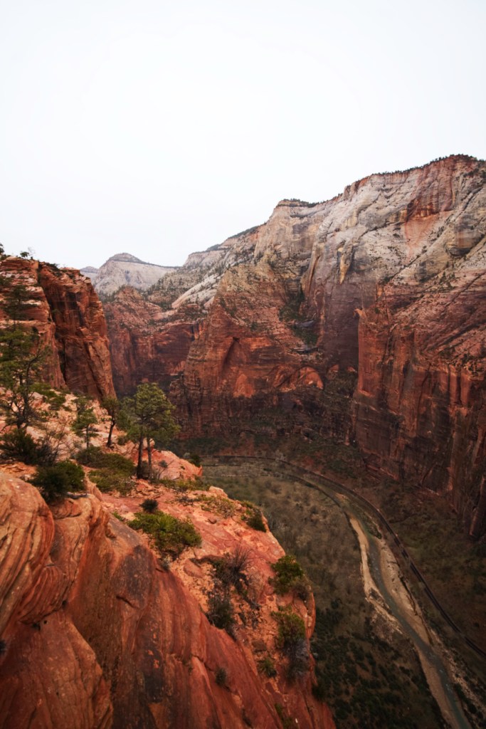
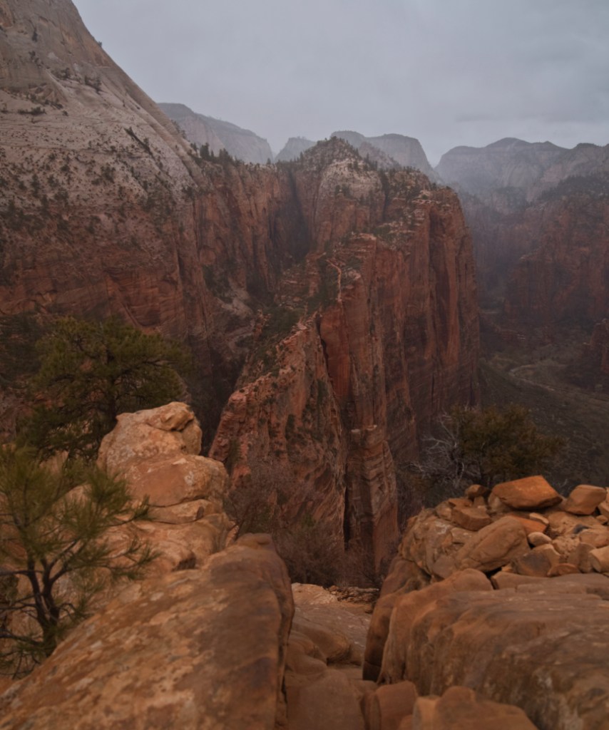
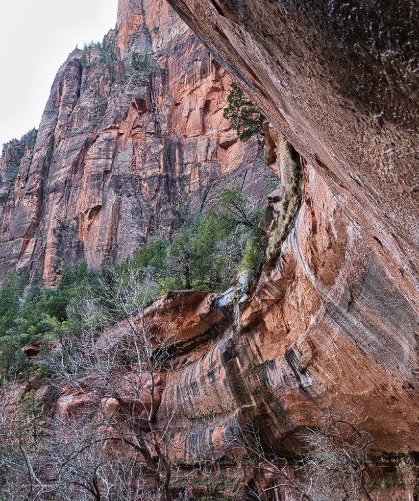
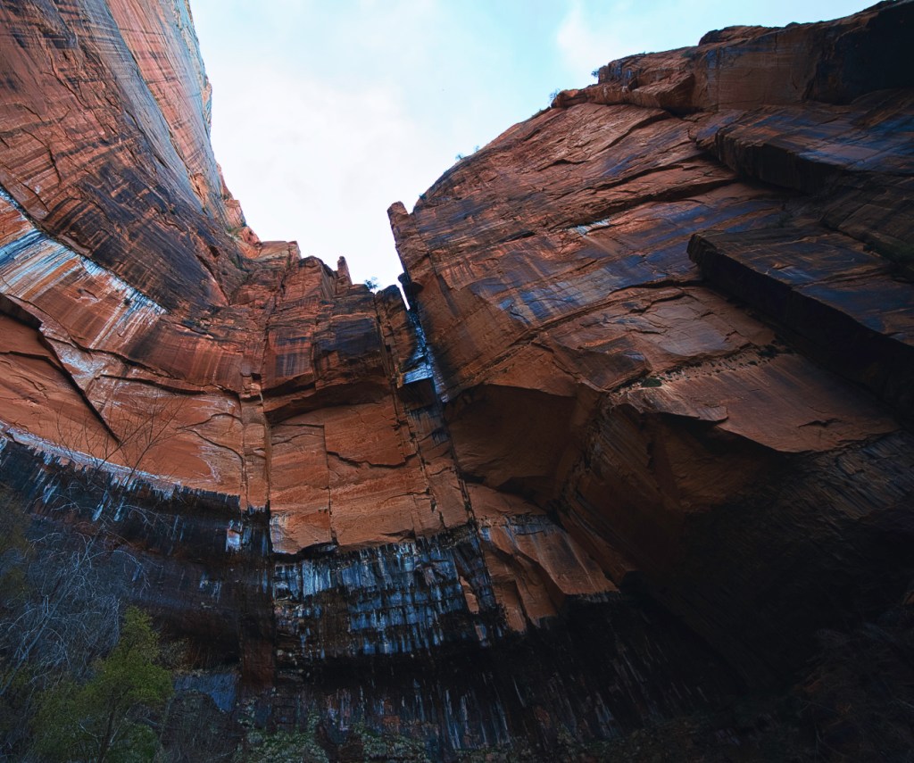
Zion National Park
Zion National Park is one of the most popular national parks in the United States with over 5,000,000 visitors annually and for very good reason. I visited in April and the remnants of winter were being shed as spring emerged in the park. There was still snow on the ground the first few visits that lead to waterfalls and beautiful wildflowers as the month progressed.
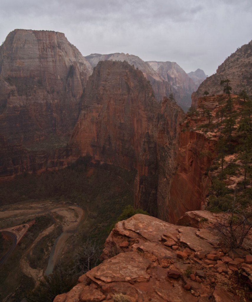
Angels Landing
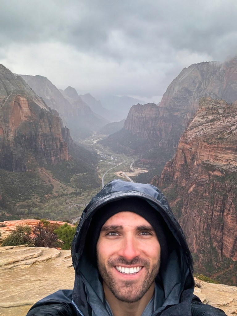
The most famous hike in Zion, and one that’s consistently rated as one of the most dangerous hikes in the United States, Angel’s Landing (AllTrails) was a blast! To ascend to the summit, you first ascend the 21 switchbacks affectionately referred to as “Walter’s Wiggles” before climbing up using chains bolted into the side of the mountain. Originally the summit was thought to be out of reach for hikers, as a Methodist preacher once remarked was “a place so inaccessible only an angel could have landed there”. I did this incredible hike shortly after finishing a much longer hike to the west rim of Zion. It was pouring rain, it was after five o’clock; with my camera mounted on tripod in one hand, conviction in my heart, I scampered up the trail towards the summit, precariously hanging off the chains with a single hand. Definitely not one of the smartest things I’ve ever done, but the view at the top is so worth it!
This one requires a permit, you can apply for the permit months in advance, although they sell out very quickly, you’ll have more luck applying for the daily lottery. If you can’t score a permit, hiking up to Scout Lookout at the base of Angel’s Landing is an awesome consolation price. If you’re afraid of heights, I definitely would not embark on this one. It’s a 1,500 foot drop off on either side, and there are some sections where there are no chains; you’re walking on exposed rock overlooking a cliff. If you’re not afraid of heights, it’s definitely worth it, and one of the coolest experiences I had in Zion.
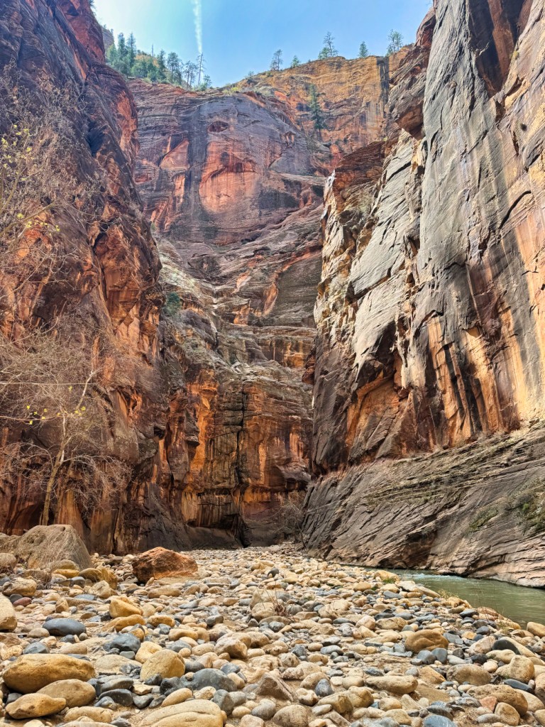
The Narrows
Arguably the second most famous hike in Zion National Park, The Narrows (AllTrails) is less about a destination and more about the journey. You make you make your way up a creek through a canyon in frigid water. This hike includes nearly 25 river crossings, some of which are chest high, most more like thigh or knee high. Depending on the time of year you go, the water can be incredibly cold.
When I went in March the water was probably in the mid-30s. RENT THE GEAR!
The park offers rental gear at a stand in Springdale that includes a set of overalls, neoprene socks, waterproof shoes, and most importantly a walking stick. The stick in particular is really useful for doing all the river crossings because the current can get strong and the last thing you want is to get knocked off your feet while you’re crossing the river.
When I did this hike in March I pulled up to the rental center and there was like a 45 minute wait to get the gear! I said fuck it and continued on, figuring I cold plunge a lot, and could do the hike without the gear. I made it three and a half miles in with no gear and it was miserable! It’s fun doing the cold plunge thing and walking up a creek that’s like mid 30s for like the first half mile, but by the time I got to mile three I was so ready to turn around and go back. I also had an experience that tripped me out.
This guy was hiking with a group of his friends, slipped, and broke his leg while he was three miles into The Narrows!! When I pulled up on the group, he had two of his friends carrying him out. With all the solo hiking I’ve been doing lately, it tripped me out and made me realize it is a really long journey and I don’t need to be doing dumb shit like hiking The Narrows with no rental gear.
In the summertime I hear the water warms up quite a bit. Zion is in southern Utah so it can get kind of hot out. I would still get the rental gear if nothing else just to get that walking stick. It makes a huge difference.

The Subway
The Subway (AllTrails) might have been my favorite hike that I did at Zion. This one’s a backcountry hike that requires you to get a permit two days in advance. What makes this hike so beautiful is it touches on a little bit of all the elements that make Zion so pretty. For the “bottom-up” approach, you start at the top of this canyon, and you make your way down into the canyon. To get to the actual “Subway“, you have to go up the stream. The journey is really beautiful: there are towering orange and black rock canyons on either side of you for most of the hike.
When I went in April, there were wildflowers blooming, little mice running around, and different colored frogs, lizards, and birds thriving in their natural habitat. About halfway out to where the Subway is, there is this area with dinosaur tracks. The whole area where Zion is used to be lush jungle where dinosaurs would roamed the Earth and thus there are a bunch of fossilized remains and petroglyphs to be found. Seeing dinosaur tracks in person tripped me out. It made me feel really small and I had a “land-before-time” moment just visualizing a bunch of dinosaurs running around the canyon that I was in.
As you get closer to The Subway, there are all these cascading waterfalls flowing over brittle red rock. The Subway is a series of emerald green pools in between a narrow canyon with walls that warp towards you, giving the appearance that you’re in a subway tunnel.
There’s also a “top-down” approach where you repel down into The Subway that requires some canyoneering experience. This is definitely something I’m going to do the next time I go to Zion. At the time, I didn’t have any formal experience or training canyoneering and it’s definitely something you want to do with a group. If you’re going solo, the bottom up is totally doable.
End-to-end roundtrip, this one took me close to five hours. You probably want to get started early in the day. You have to go to the Zion Visitor Center inside the park to get the permit from a ranger before you start this one. The permit is a lot easier to get than the one for Angel’s Landing, at least for the Daily Lottery. I had an awkward moment when I went to go pick up the permit.
I went at like 11 o’clock in the morning and the ranger was giving me a hard time that I was starting the hike too late. After reassuring her that I had a headlamp and that I knew what I was getting myself into, I headed out on the nearly hour drive to the trailhead in the Zion backcountry. In the back of my mind I knew there was no way it was going to take the seven to eight hours that she was trying to tell me that it was going to take. I can hike like 25 to 30 minute miles and I think I did the whole thing in like five hours and 45 minutes. That included staying at the subway for like 30 minutes to take pictures.
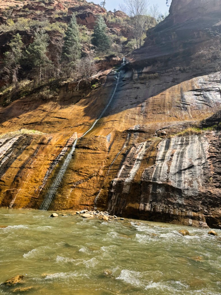
Emerald Pools
Emerald Pools (AllTrails) is a shorter hike that is normally a loop between Zion Lodge (shuttle stop 5) and The Grotto (shuttle stop 6). When I went in March, the trailhead beginning at the Zion Lodge at stop 5 was closed due to the bridge being out for construction. This made the loop hike an out-and-back starting and ending at The Grotto. Once you cross the bridge over Virgin River, going right will take you to Scout Lookout, Angel’s Landing, and the West Rim. Going left takes you to Emerald Pools. The hike goes up a set of stairs and then opens up to the whole Zion Canyon where there are some great panoramic photo opportunities!
As you make your way around the mountain, you first come up to the Lower Emerald Pool Falls. When I went, the waterfall wasn’t really running. It was little more than a trickle into a little pond that had formed at the bottom. There’s a concrete paved trail, with a handrail that allows you to walk out for more panoramic views at the end.
After you do the lower falls, you go up a hill and to get to the middle falls. It was crowded and not that spectacular around the middle falls, so I continued onward up the trail leading to the upper falls. The upper Emerald Pool falls are magnificent!
There’s a sheer rock cliff that drops off, creating a 100 foot waterfall that feeds a pool beneath it. There is cyanobacteria in the water at Zion and it’s best not to get in. The upper falls offer some epic photo opportunities for those willing to make the whole journey.

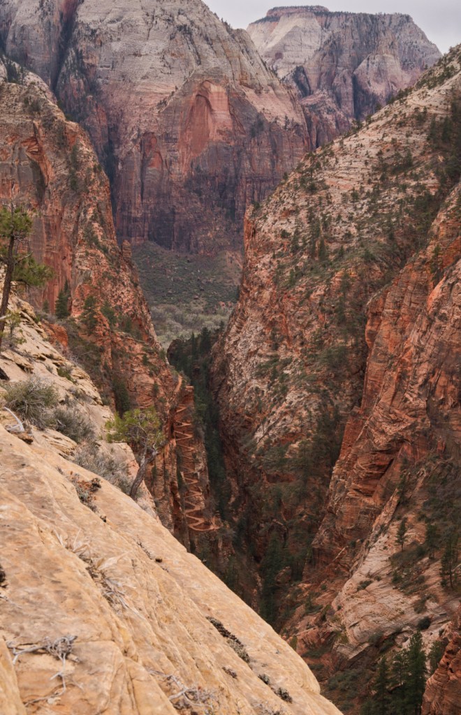
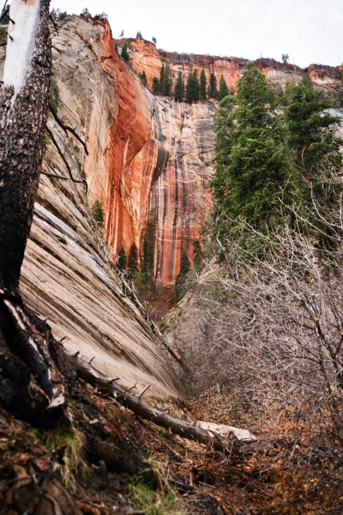
West Rim
Western Rim (AllTrails) was the longest hike I did in Zion National Park. This nine mile round trip hike is a beast and not meant for the faint of heart. There’s a significant amount of elevation gain, mostly on the back end of the hike. As the name suggests, it takes you to the western rim of Zion Canyon. You pass through Scout Lookout at the base of Angel’s Landing on your way up. When I went in March, there was a fair amount of snow still on the ground. The contrast between the snow and the orange and black rock faces was truly a sight to behold. The views from the top of western rim were also spectacular, as they offer a bird’s-eye view of the entire Zion Canyon.
Zion Canyon Overlook
Zion Canyon Overlook (AllTrails) is an easy one mile roundtrip hike whose trailhead is right off Zion-Mount Carmel Highway. The hike up leads to a breathtaking view of the entire canyon with the highway snaking through the foreground. This one is awesome to do around sunset; when I went there was a photographer taking portraits of her friend during golden and blue hours. This is also a spectacular place to partake in astrophotography – be sure you bring a headlamp to make your way back safely!


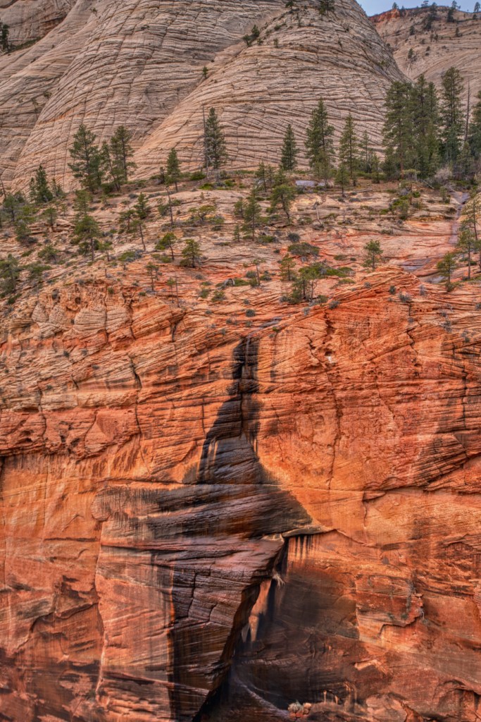
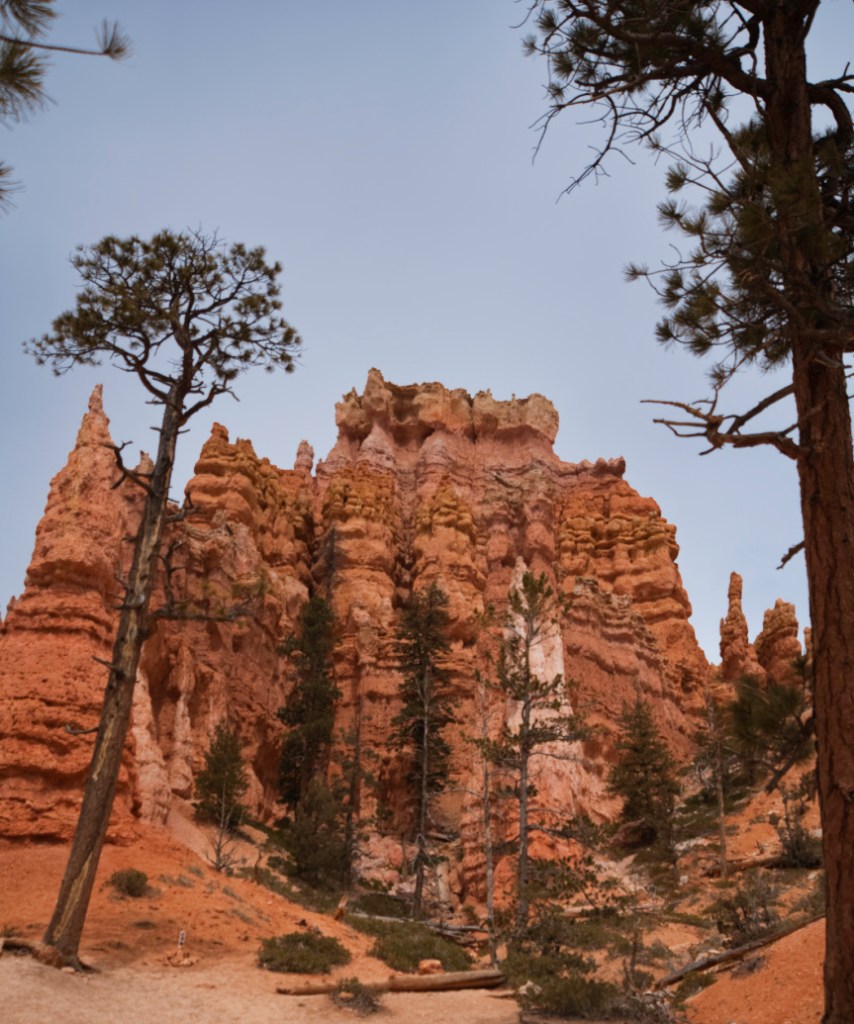
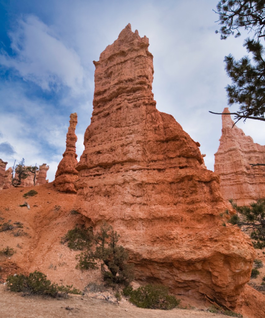
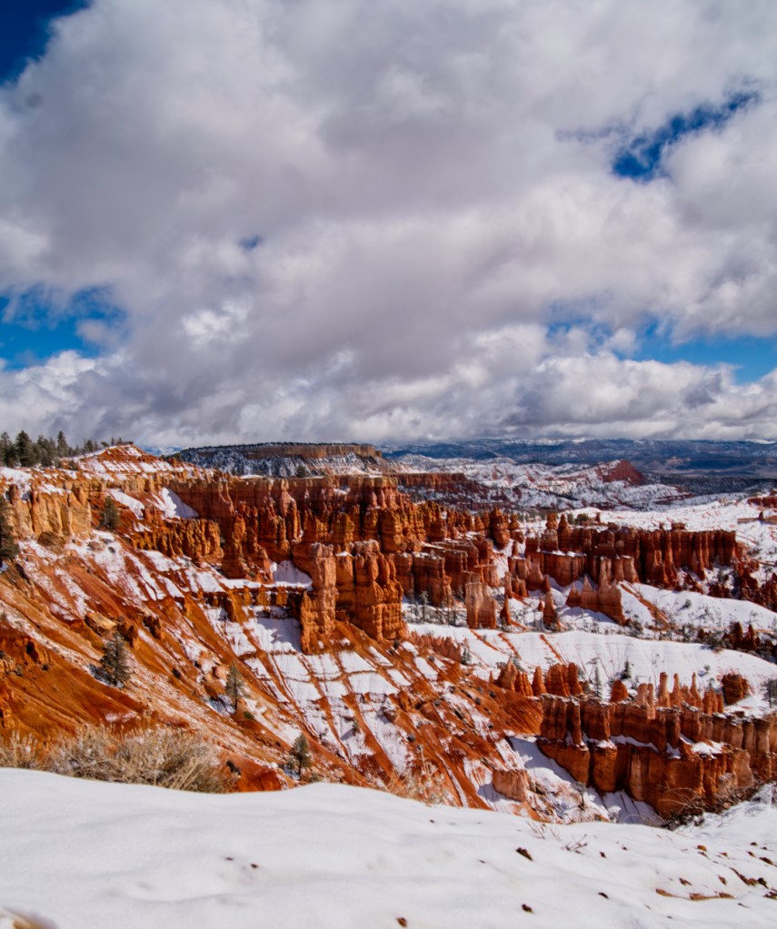
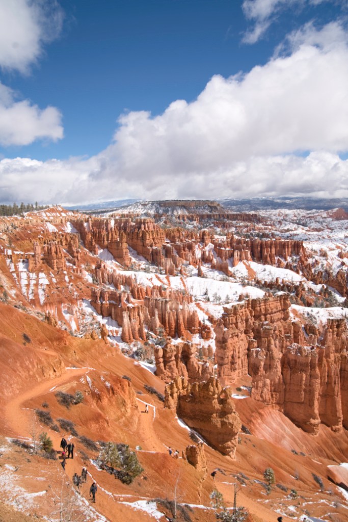
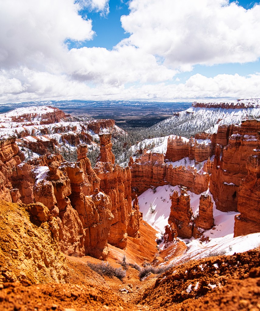
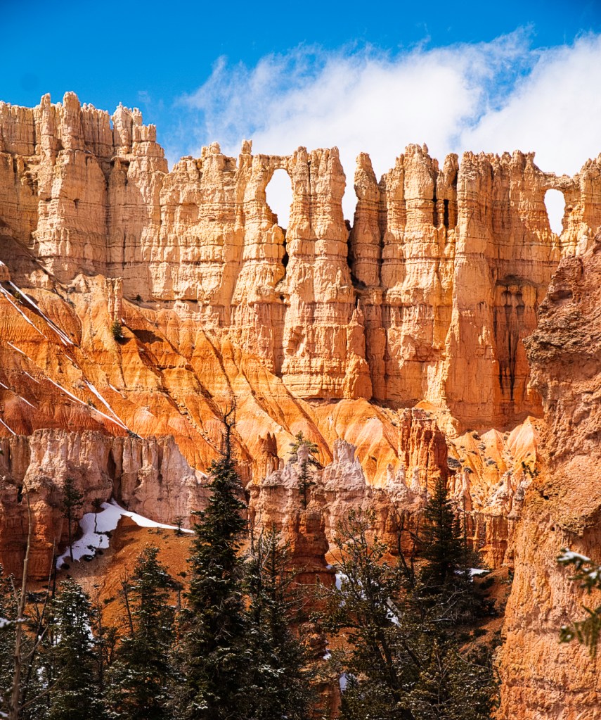
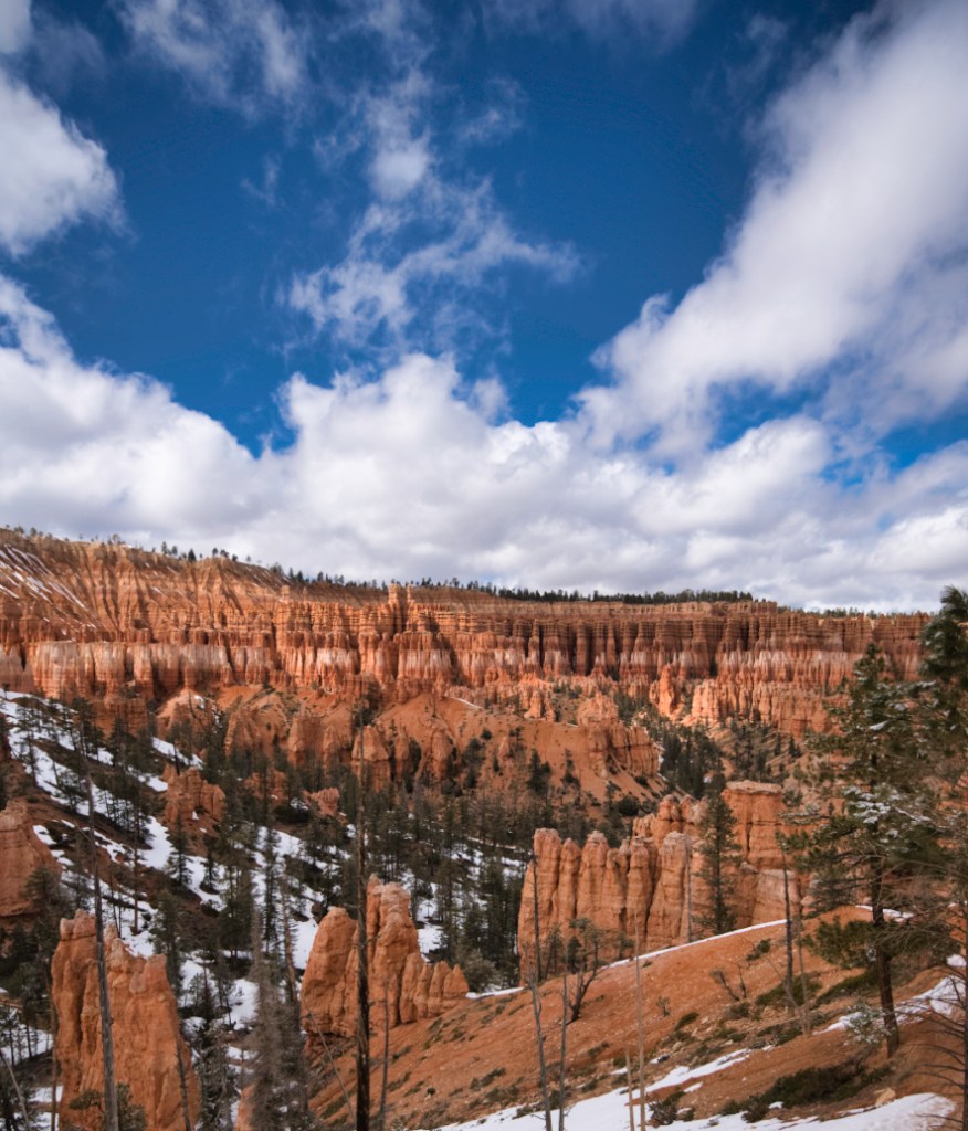
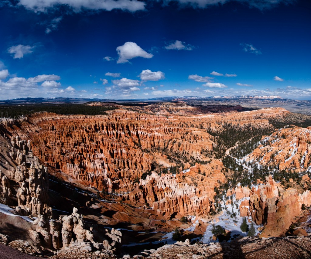
Bryce Canyon National Park
Bryce Canyon is a 90 minute drive from Kanab and 100% worth the journey. It’s a much smaller park compared to Zion. What it lacks in size it makes up for in beauty. When I went in early March, the canyon had gotten a fresh round of powder snow the night before.
The hoodoos stood out in the orange and white landscape and the snow made an incredible foreground. All of the hikes I did in Bryce Canyon were extremely muddy on account of the snow melting in the unforgiving Utah sun. I highly suggest bringing a pair of micro spikes if there’s even a remote chance of precipitation. You don’t want to risk a slipping and falling, especially going downhill on some of the steeper declines.
Queen Victoria via Queens Garden Trail
Queen‘s Garden Trail (AllTrails) leads to a rock formation affectionately known as Queen Victoria. This 2.2 mile loop only gains 450 elevation and takes about an hour to do roundtrip. The trail begins at Sunrise Point and is an excellent option for those who aren’t quite in the mood to do the much longer Navajo Loop to Peekaboo Trail. You still get to experience the awe inspiring feeling of hiking amongst towering hoodoo and rock formations that have been carved out by millions of years of wind and water. I’m not gonna lie, I did not really see the resemblance to Queen Victoria at the end of the trail, but had a lot of fun ducking my head walking through natural rock arches and letting my imagination run wild looking at the various rock formations present!

Navajo Loop to Peek-A-Boo Trail
Navajo Loop, to Peekaboo Trail (AllTrails) is a 6 mile round-trip hike that first descends then gains nearly 1500 feet elevation, beginning from Sunset Point. I went the last day of March and this one took me nearly 3 hours of moving time, closer to 4.5 hours if you count all the times I stopped to take pictures of the towering hoodoos that stood out amongst the fresh powder snow that had fallen the night before. If there is snow present, I highly recommend bringing a pair of micro-spikes to prevent any slipping and sliding as you descend into the canyon. There were plenty of people who did not have micro spikes, and it looked miserable as they nearly slipped, risking a plummet down the narrow cliff face. This trail is also known as the “Figure 8 Loop” as the first part of the trail takes you through the Wall Street trail, past Thors Hammer rock, past the Two Bridges formation and then onward to the Peekaboo trail. I went clockwise starting with Navajo loop, then doing the entirety of Peekaboo Trail, camera in hand as I returned back through Navajo Loop. When I went, the Wall Street Trail was closed due to a rock slide. I highly recommend checking the most recent reviews on AllTrails before you head out on this hike. It’s better to have an awareness of what parts of the trail are open before you begin!


Lower, Mid, and Upper Inspiration Point
Lower, Mid, and Upper Inspiration Point (AllTrails) is a great option in Bryce Canyon for those with limited mobility. You can drive right up to the trailhead and there are lower, middle, and upper viewing decks. There’s a bit of a steep hike, only three-quarters of a mile round trip, up to the upper observation deck that’s been coined “Inspiration Point“. Be careful if there is snow and ice present on the ascent! When you make it to upper observation deck, you are rewarded with a bird’s eye view of the whole canyon. Towering columns of hoodoos stand out like soldiers on guard and it is an excellent place to take panoramic photos.
Capitol Reef National Park
Capitol Reef is the least visited of Utah’s mighty five national parks, mostly due to the fact that it’s very remote. It is a two and a half hour drive from Kanab to get to the park. The gateway town for the park is Torrey, Utah. The park is the main attraction and there’s really not much else to do other than eat or sleep. There are a handful of restaurants, including a steakhouse that was half decent.
Due to the fact that it is way out in the middle of no where, the park is an awesome place to do astrophotography! I didn’t get a chance on this trip on account of some cloudy evenings.
I drove up here after my work week ended and stayed a night at a local hotel before waking up the next day to explore the park. After exploring for a day, I headed back to Kanab. In my opinion, you only need one day and maybe a (clear) night to see the parks offerings.
Hickman Bridge
Hickman Bridge (AllTrails) is a natural land bridge in Capitol Reef National Park and one of the most frequently recommended attractions the park has to offer. The concierge at my hotel strongly recommended seeing this one and Cassidy Arch. A nearly 130 foot spanning bridge is accessible via a gentle two mile round trip hike that starts and ends alongside the soothing sounds of Sulphur Creek. When you arrive at the base of the bridge there are multiple different angles to take pictures of the bridge. Be sure to walk underneath the bridge to catch some different angles of this massive land bridge!
After you’re done snapping some photos, be sure to check out the Rim Overlook, which provides gorgeous views of the Waterpocket Fold and the Fruita schoolhouse, a single room school that was used to educate children of the Fruita community in the late 1800s and early 1900s. The school is staged to appear as it did during its heyday and succeeds at taking visitors back in time to what life was like living in a super remote area over a hundred years ago. Also visible along this trail is the mountain the National Park is named after. Look for the rock that loosely resembles the Capitol Building in Washington D.C!

Cassidy Arch
Cassidy Arch (AllTrails) is a spectacular arch located about 15 minutes into Capital Reef from the visitor center. It gets its name from the famous outlaw Butch Cassidy who allegedly hit out in Capital Reef while on the run from law enforcement.
To get to the trailhead leading up to Cassidy Arch, you have to turn off onto a lightly grated dirt road before continuing onward to the trailhead parking lot that is nestled deep within the canyon. I went super early in the morning before going over to Hickman Bridge. In the early morning it was beautiful seeing the sun come up over the wall of the canyon, illuminating the red, orange, and white rock.
The hike up to the arch is a moderately stressful 3.5 mile hike that gains like 700 elevation. The arch is a bit hidden if you don’t know where to look. You can see the arch if you stop your car, park, and look up before going around the bend to the parking lot. When you hike up the arch, it wasn’t very intuitive for me to see through the window of the arch, and I had to actually walk around a bit before I found the angle containing the window vantage point. There was a group of hikers rappelling down into the sinkhole that the arch spans over, and it looked like quite the adventure if you’ve got the gear for it!
Grand Staircase – Escalante National Monument
While technically a national monument, falling just short of the coveted National Park designation, Grand Staircase – Escalante is a massive area of protected land, definitely worth seeing if you’re going to be spending any time in southern Utah. There are so many hikes in this national monument, I didn’t even get to some of the bigger ones that I wanted to, like Coyote Gulch.
The area is incredibly remote, and I strongly recommend having a vehicle with four-wheel drive if you’re going to attempt driving out to some of the more remote hiking locations, such as The Cosmic Ashtray. There’s a lot of deep sand in this part of the world, and 4×4, preferably high clearance as well, are necessary to get your vehicle through the sand without getting stuck.
Those seeking solitude will love the remoteness of the area. At some of the more popular hikes, there are bound to be people congregating near the beginning of the trail, but as you move deeper into the wilderness, you’ll be rewarded with solitude and lots of peace and quiet.
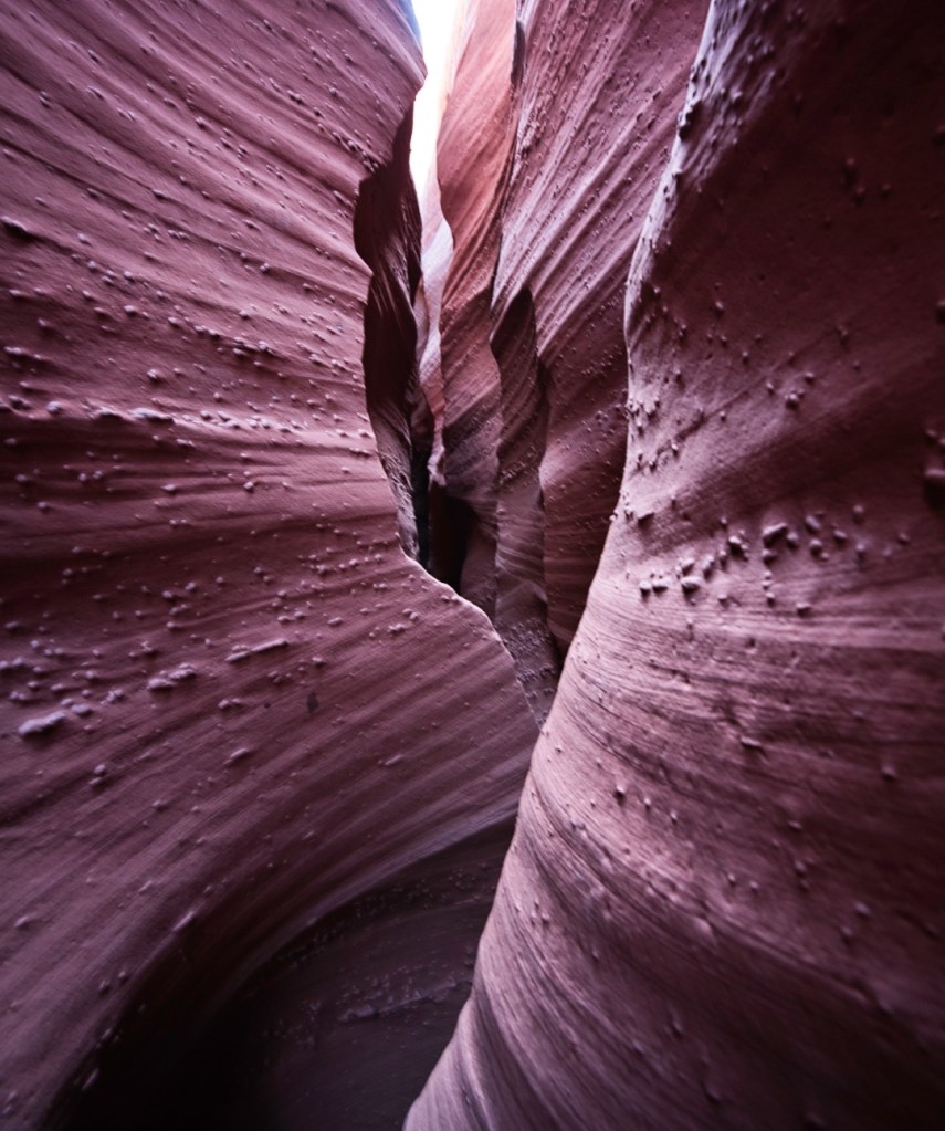
Peek-A-Boo / Spooky Gulch
Southern Utah and Northern Arizona are world-renowned for the slot canyons found in this area. Slot canyons come in two different varieties:
- A-frame
- V-frame
The A-frame slot canyon, as the shape of the letter suggests, is a peak up at the top that widens out as the canyon walls get closer to the ground. An V-frame canyon is the opposite, where the canyon is extremely narrow down at the ground and begins to widen as the walls of the canyon reach towards the sky.
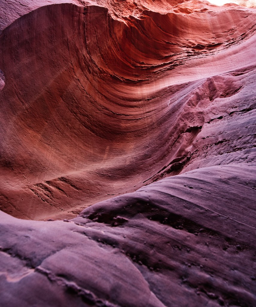
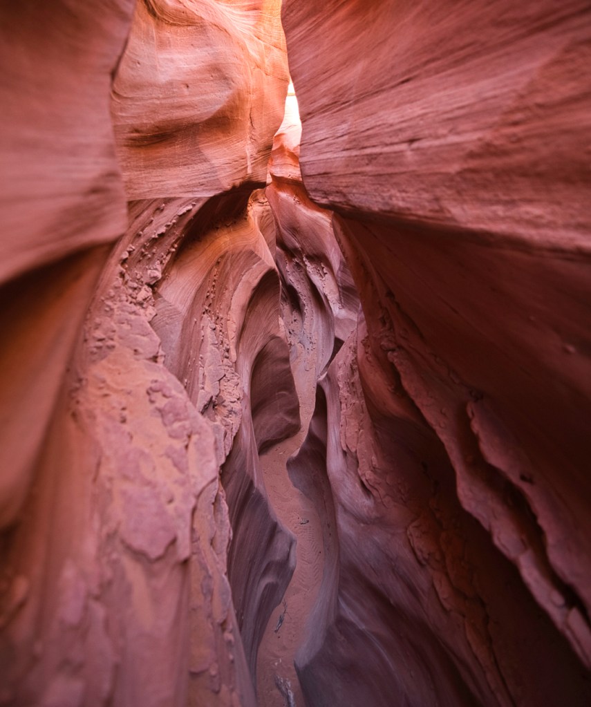
Peek-a-boo and Spooky Canyon (AllTrails) are two slot canyons in Grand Staircase Escalante that are of the V-frame variant. The defining characteristic of a slot is the way the sunlight bounces around the walls of the canyon, creating wonderful colors. I went late afternoon and both slots were lit up in hues of purple, blue, and orange. The nice thing about these two slot canyons is they are connected by a loop, and you can easily knock both out in an afternoon. I went clockwise, beginning with Peek-a-boo Canyon and ending at Spooky Canyon.
To get to Peek-a-boo and Spooky Canyon, you have to go down a dirt road for about 45 minutes, called Hole in the Rock road, or as the locals have affectionately nicknamed it, “Hole in a Tire” road. You want to be careful driving and keep your head on a swivel for potholes, boulders, and rough sections of road if you don’t have four-wheel drive and high clearance. That said, the trailhead is accessible for vehicles with only two wheel drive – my RAV4 had no problem.
For those that are claustrophobic, you’ll want to skip this hike, as there are sections of both canyons with less than a foot of clearance between the canyon walls. If you’re wearing a backpack on your hike, you’ll have to remove the pack and drag it behind you at times, as there is no way to shimmy sideways through these narrow crevices.
There are some sections that require scrambling and a bit of climbing to get through Peek-a-boo Canyon, and there are definitely some sections within Spooky Canyon that require you to drop 5 feet. Comparison is the thief of joy, but if I had to pick my favorite, I’d say it was definitely Spooky Canyon. It’s far enough out into BLM land that if you’re too tired to drive back, you can camp out there.
Lower Calf Creek Falls
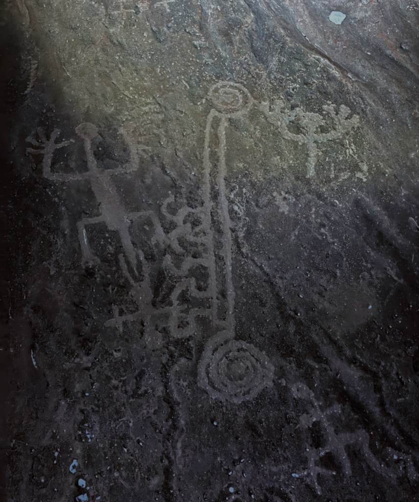
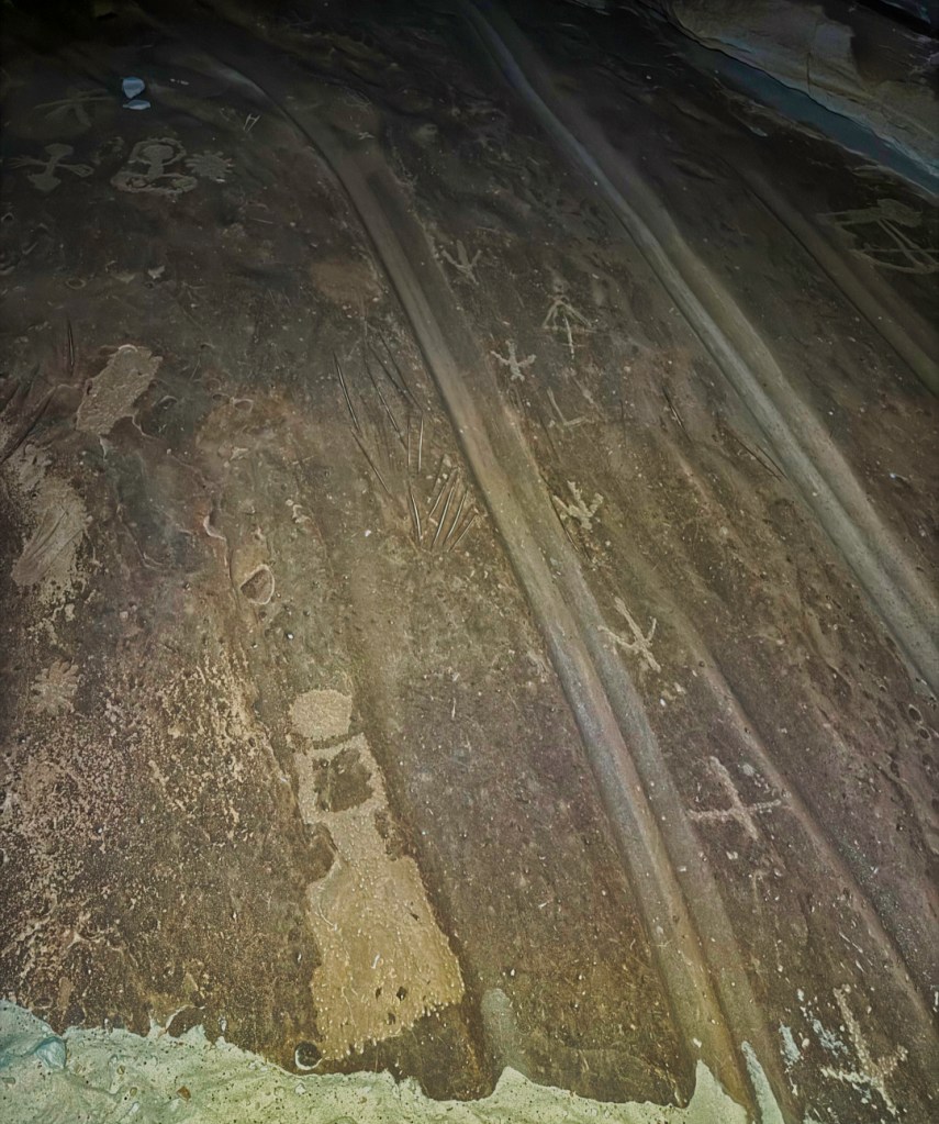
Lower Calf Creek Falls (AllTrails) is a 100-foot waterfall located in the middle of Grand Staircase Escalante. Just off the main highway that runs through the park all the way up to Capitol Reef National Park. A six-mile trail roundtrip. This hike takes you past petroglyphs and along a creek amidst towering rock face. When you get to the actual falls, the alpine green color and soothing sound of the waterfall is a welcome sight.
I met some friends at the base of the waterfall and ended up going on a wild adventure that I will be detailing in a future blog post of short stories recounting true happenings stranger than fiction that I’ve experienced throughout my nomadic journey.


The Cosmic Ashtray
The Cosmic Ashtray is a natural rock bowl formation filled with red sand that has a boulder smack in the middle of the bowl. Getting to The Cosmic Ashtray involves driving through deep sand and requires 4×4 drive. High clearance is not required but isn’t a bad idea to avoid scraping the bottom of your car. Once you park the car, it’s a few miles roundtrip to the view below.
Vermillion Cliffs National Monument
Vermillion Cliffs National Monument straddles the Arizona – Utah border, encompassing 280,000 acres and is host to some of the country’s most picturesque geologic formations.
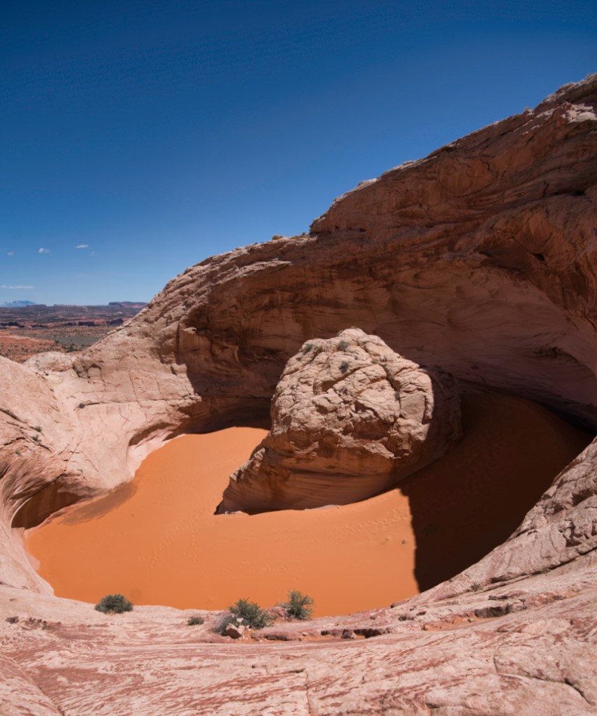
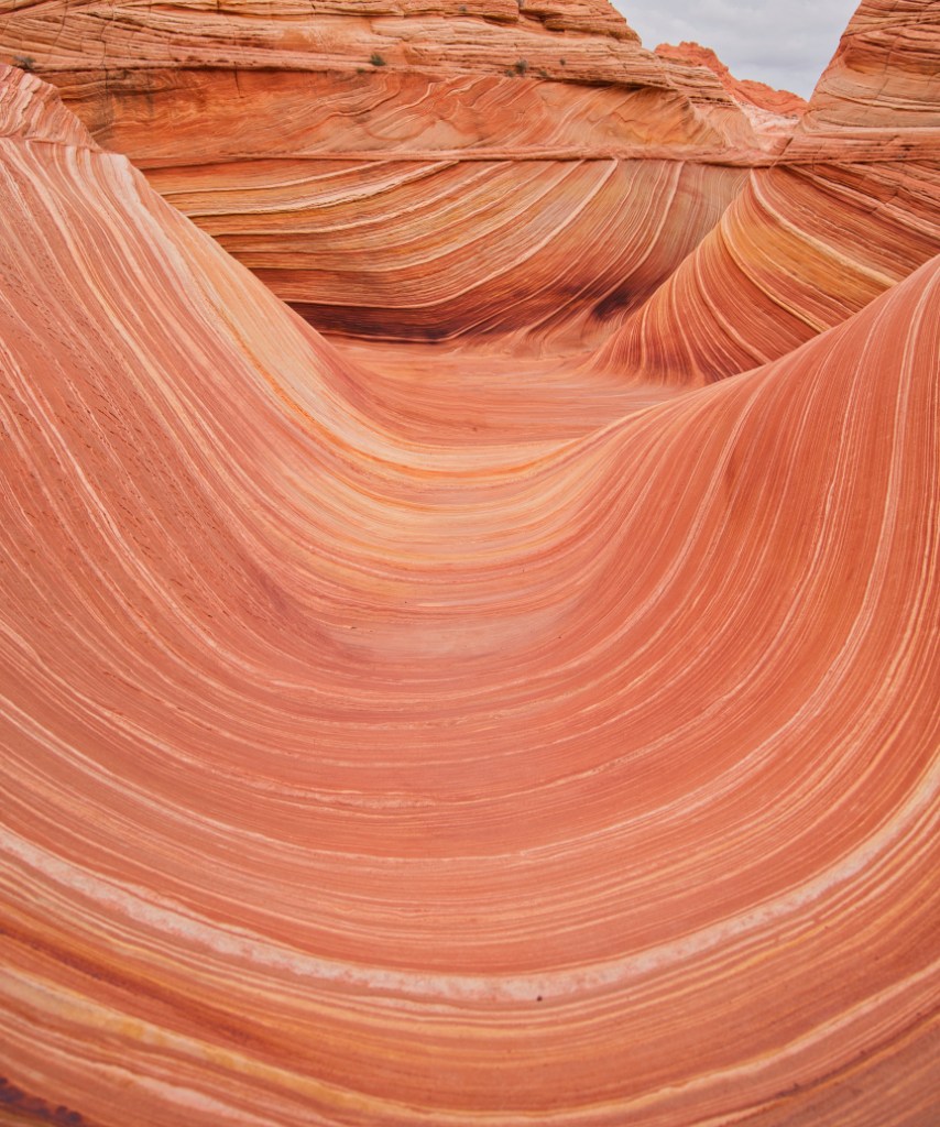
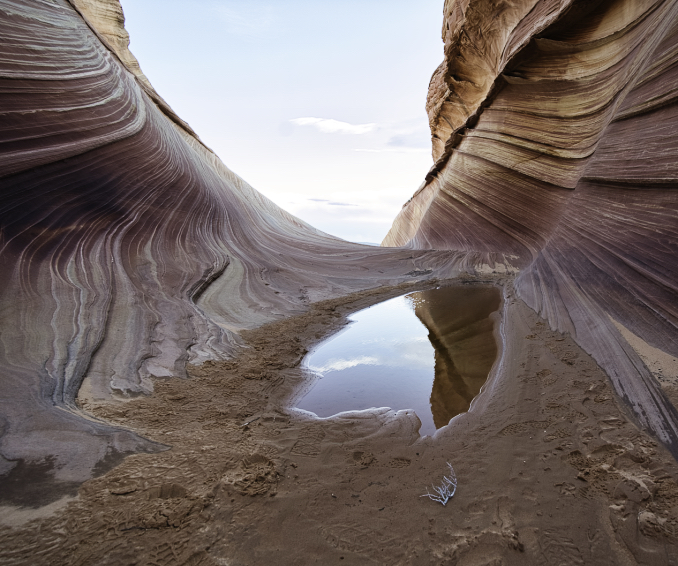
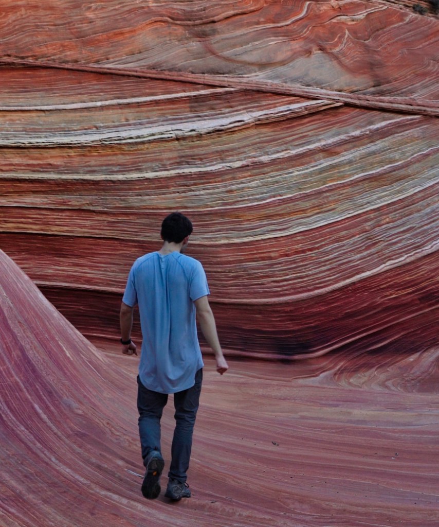
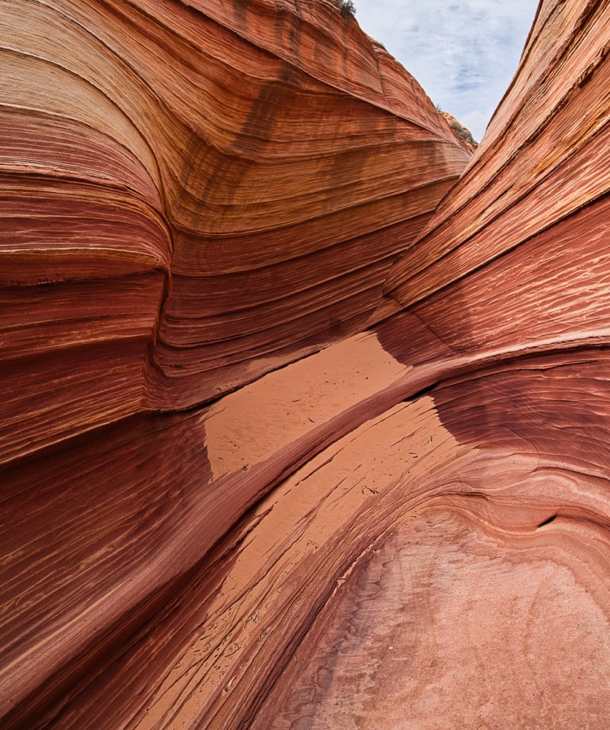
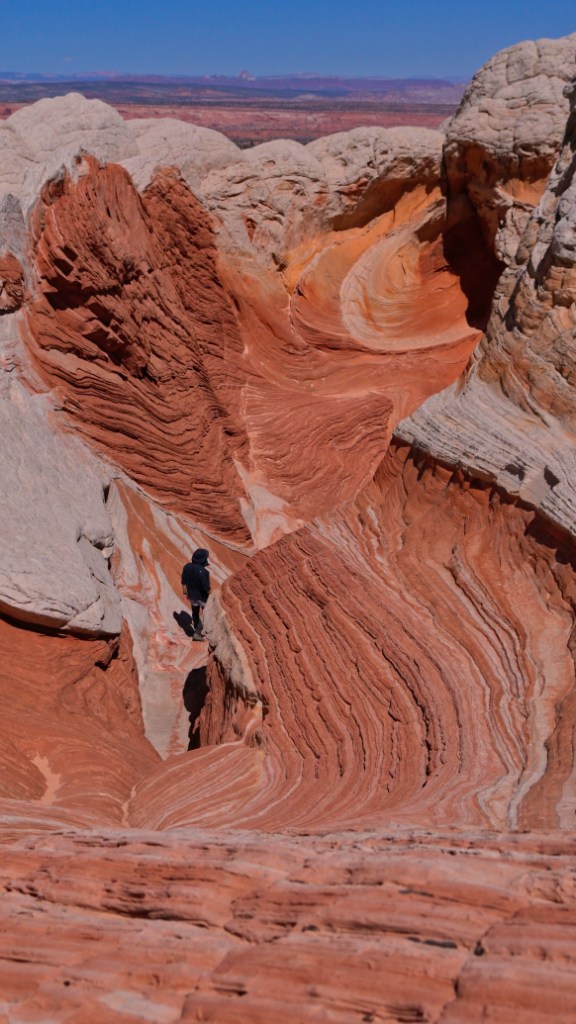
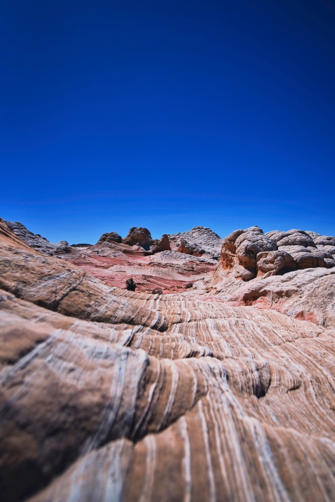
The Wave
The Wave (AllTrails) is a beautiful sandstone rock formation that has been carved out by millions of years of wind and water. The day I went it had rained the previous evening, turning the sand into rosy shades of pink that made the landscape look like cotton candy land when viewed from above. I got to The Wave shortly after the sun had risen and stayed until early afternoon before it was set to rain again. It was fascinating observing how the color palette changed as the sun came up and the sandstone dried out. The area containing the most photographed formation is very small and contains three main photographic angles as detailed in this blogpost. Many people don’t venture out beyond the main formation and miss out on other gems in the Coyote Buttes North region like Top Rock Arch, Dune, and Melody Arch. Next time I come back, I’m planning for an astrophotography shoot! You’re fine to make it to the trailhead with a 2WD vehicle.


Permit
After being included as a built in screensaver option in Windows 7, The Wave has become one of the most sought after photography destinations in the world. To conserve the natural beauty of the rock formations, BLM instituted a strict permit system that only allows 64 people per day to step foot in the Coyote Buttes North region of Vermillion Cliffs. If you get caught trespassing in the Coyote Buttes North region, it is a $10,000 fine. You have two options to secure a permit for the wave:
- Advance permit
- Daily lottery, two days prior
The advance permit system is online and open like 90 days before the date of your hike. An entry into the advance permit system does not guarantee access, only a chance at winning. The daily lottery is $2 per entry and uses a geofence to limit applicants to the geographical region surrounding Coyote Buttes. The fence does not reach down to Sedona, thus I had to wait before I was settled in Kanab to play. I played and lost the daily lottery 8 times before winning! Don’t get discouraged if you don’t win the first few times applying for it.
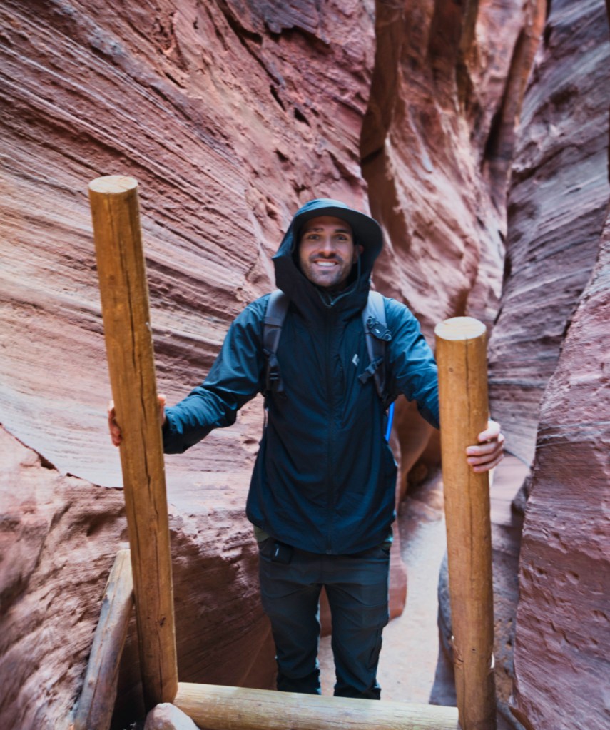
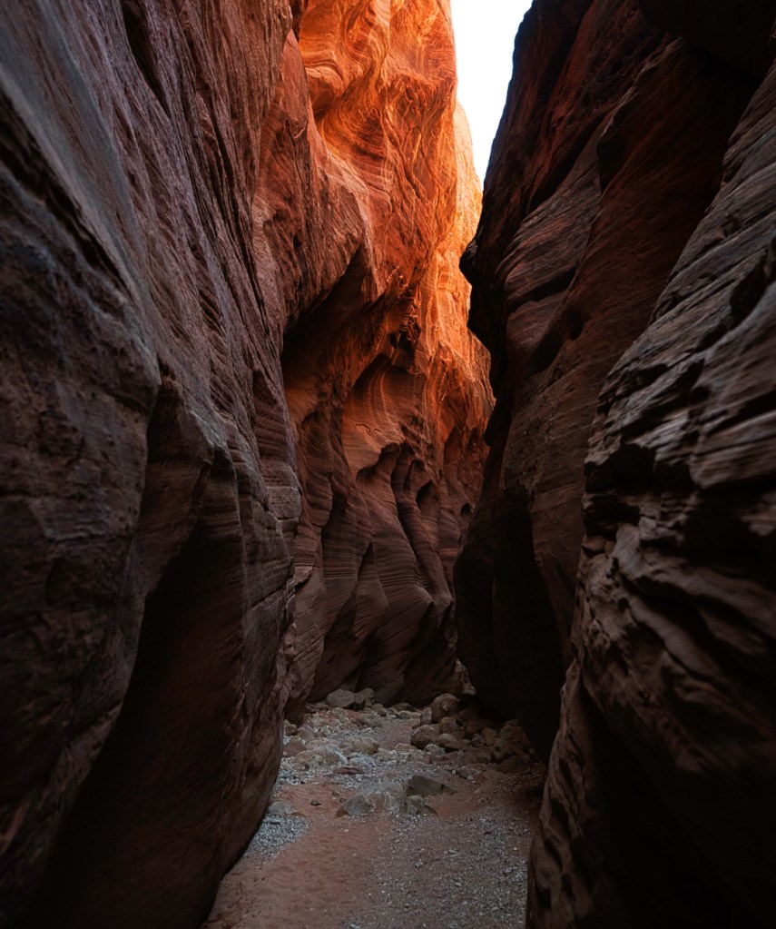
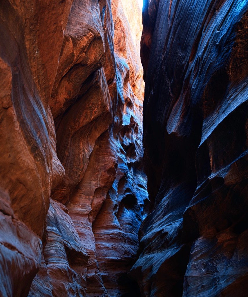
Buckskin Gulch
Buckskin Gulch (AllTrails) shares the House Rock Valley trailhead with The Wave and is accessible via dirt road off Highway 89. You’re fine to make it to the trailhead with a 2WD vehicle. To get to Buckskin Gulch, one must traverse through Wire Pass slot canyon and climb down ladders, shimmy through tight spaces, and pass petroglyphs along the way! Buckskin Gulch is part of the longest slot canyon in the world. This hike is much more about the journey than the destination, with the trail eventually leading to seasonal water that pools up in the canyon after it rains.
White Pocket
Some consider White Pocket (AllTrails) to be a “consolation price” for those who don’t win The Wave lottery. I don’t think this characterization is fair as White Pocket feels just as other worldly as The Wave! The colors are much different at White Pocket and include deep reds, bright orange swirls, and shades of pink. It was a blast trekking from shot to shot through the alien landscape.
You absolutely must have 4×4 drive and high clearance to make it out to White Pocket! There is a lot of deep sand that only a 4×4, high clearance vehicle can handle. White Pocket is WAY out, like 50 miles down the dirt House Rock Valley road out there. I rented a Jeep Gladiator from Roam for the day to make the trip and could not have been more happy with the vehicle!

Kanab
Kanab has some cool hikes located within and just outside the city limits.
Mansard Petroglyphs
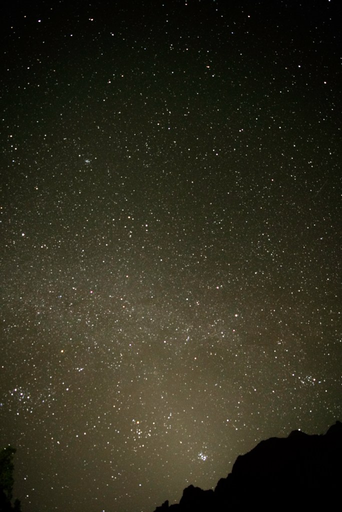
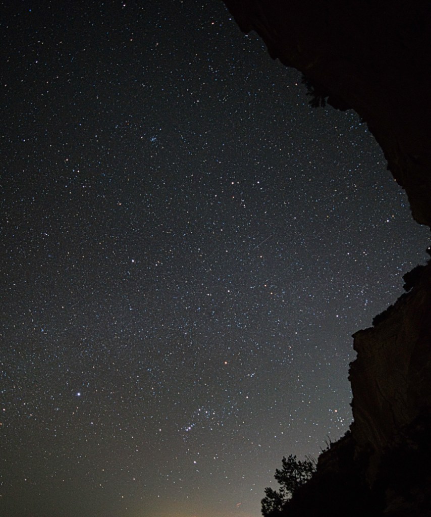
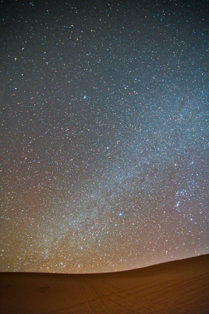
Mansard Petroglyphs (AllTrails) are a series of petroglyphs at the end of a 2.5 mile trail that takes you up over 900 elevation. I was bored after work one night and the trailhead is right behind where my Airbnb was. It’s a great place to shoot the stars as Kanab is incredibly dark and the elevation gain puts you high enough up above the light pollution. I went up to take some shots of the stars and didn’t even realize that there would be petroglyphs awaiting me at the end of the hike. Such a pleasant surprise!
Sand Caves
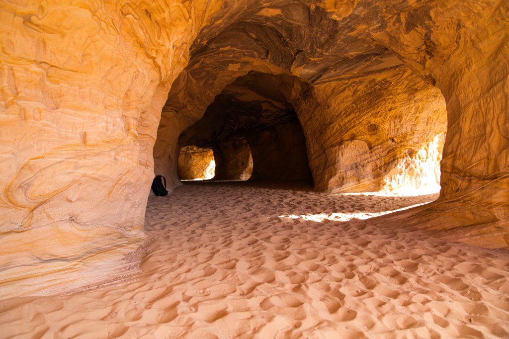
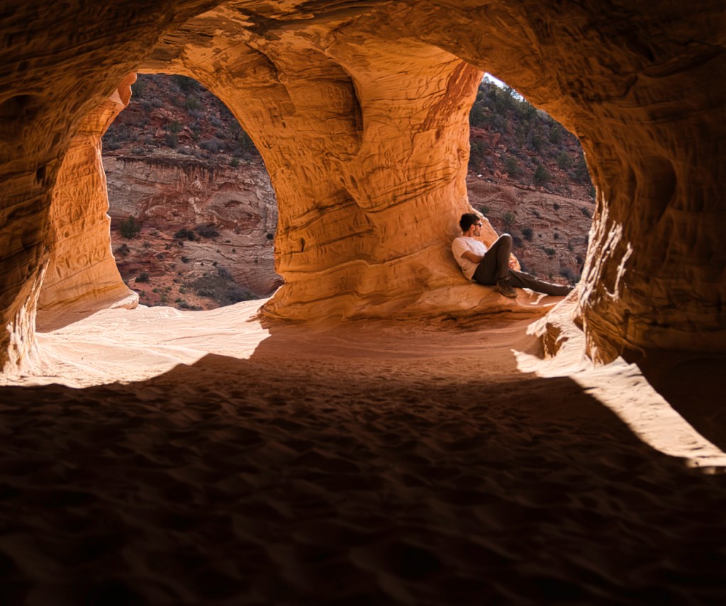
Sand Caves (AllTrails) are a series of man made caves that are just outside Kanab city limits with the parking lot next to the entrance to Best Friends Animal Sanctuary. A very short hike leads you up the cliff face to the caves. This hike is kid friendly and highly accessible. The only treacherous part is scaling the smooth rock on the cliff face on the way up. As the name suggests, there is plenty of sand inside the caves and a handful of openings that make for cool pictures.

Toadstool Hoodoo
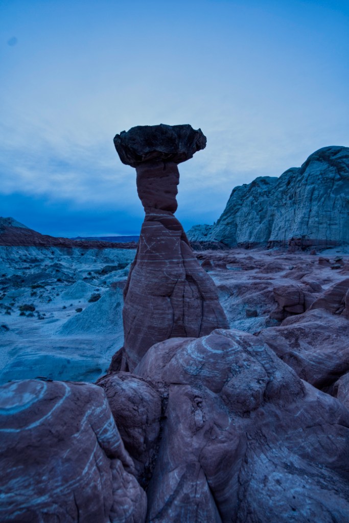
Toadstool Hoodoo (AllTrails) is a a quick 1.5 mile roundtrip pit stop off Highway 89 between Page, AZ and Kanab, UT. I went here during blue hour and the hoodoos provided an incredible subject amidst the setting sun.
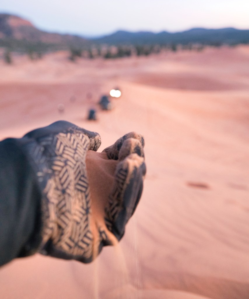
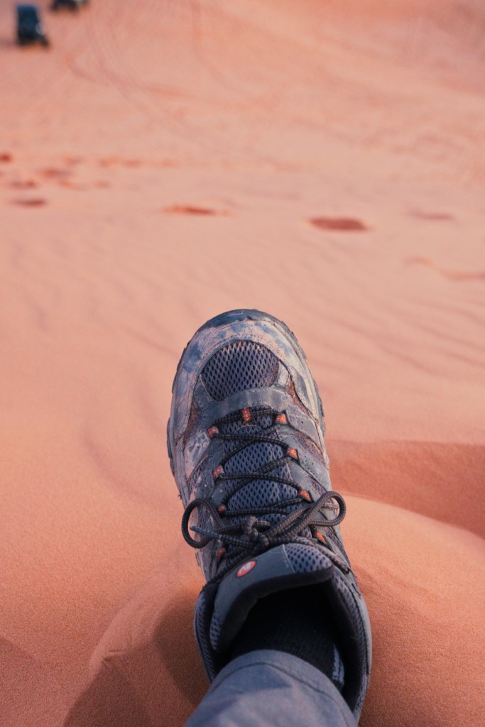
Coral Pink Sand Dunes
Coral Pink Sand Dunes (AllTrails), as the name suggests, are a series of sand dunes outside Kanab city limits across the street from the Best Friends Animal Sanctuary exit. The sand really is pink when examined up close! The State Park costs $15 to enter; has OHV rental and sandboard rentals onsite. This is also an awesome place to partake in astrophotography! Walking through the sand is no joke and a lot of strain on the calves, something I learned hiking up the dunes to go sandboarding.
Sandboarding
Sandboarding was a sport I didn’t even know existed until I began researching things to do near Kanab! You basically
- Hike to top of dune
- Take shoes off
- Strap board to feet
- Board down the dune
- Repeat!
I made a short video about the experience. Spoiler: I fell. A lot.
Kanarraville
Kanarraville is a town in southwest Utah about an hours drive north of Hurricane that is home to the stunning Kanarra Falls.
Kanarra Falls
Kanarra Falls (AllTrails) may have been my favorite hike in all of Southern Utah. It is $15 to get access to hike to the falls. Located in Kanarraville, this hike has a little bit of everything Southern Utah has to offer: the soothing sound of a running creek, slot canyons, a Narrows-esque experience walking upstream against the flow of the creek current, ladder climbs, and a beautiful waterfall at the end of the trail. If you are in the area and only have time to do one hike, Kanarra Falls is my recommendation!


OHV
Southern Utah is way too remote to hike around. You’re likely to see more cool stuff if you have an Off-Highway Vehicle (OHV) with 4×4 drive and high clearance. Although more of a nice-to-have and not required for every off-road trail in Southern Utah, 4×4 drive and high clearance are 100% required for all the trails called out in this section.
White Pocket
This is one of the most remote places I’ve been in the Southwest USA. To get here, you have to drive nearly 40 miles down the dirt House Rock Valley road. I strongly recommend obtaining a paper copy of the map from the BLM office in Kanab before heading out as the route Google Maps takes you down is incorrect. The drive down the washboard House Rock Valley road isn’t too bad and was totally doable in my 2WD Toyota RAV4. In my RAV4, I drove a tame 30 MPH because I wasn’t trying to fuck up the alignment; when I rented a Jeep Gladiator to get out to this trailhead I cranked that up to like 65 MPH, almost crashing into a sand bank in the process. The deep sand gets hairy when you turn down Pine Tree road and it turns into Big Sink road. This is where I put the Jeep in 4×4 mode and had to slow down to 25 MPH. The drive down Big Sink includes a few rock climbs and sand all the way out.
Great Chamber at Cutler Point
I made this journey (AllTrails) the same day I rented the Jeep Gladiator. Originally when I was researching the Great Chamber, I intended to hike nearly 10 miles out. I’m so glad I didn’t and just drove. This road is mostly deep sand all the way out and would be quite difficult to attempt walking through. I kept the Jeep in 4×4 for pretty much the entire drive until getting to the base of the Great Chamber. From here it was about a mile roundtrip trek up to the Chamber, saving me a long, arduous nine mile hike through deep sand.
The Cosmic Ashtray
To get out to The Cosmic Ashtray, I carpooled with some friends I met at Lower Calf Creek falls and we made the trip in a Subaru that had a constrained 4×4 drive that only allows for speeds up to 25 MPH. This journey starts along Hole in the Rock road along the same path that takes you out to Buckskin and Spooky Gulch before a left turn takes you deeper into the Utah desert. After parking the car, we continued on foot for a mile or two before climbing up the rock slope to get to The Cosmic Ashtray overlook.
Water
Sand Hollow
Sand Hollow is a lake in southwest Utah, closest to the town of Hurricane. A man made lake, this body of water is large and deep enough to take a boat or jet ski out on! There is a cool rock formation that you can drive right up to and jump off of. In April the water was pretty cold. The folks I saw who rented jet skis, mobbed up to the rock formation, jumped off, and swam back to their jet skis had the right idea!
Food
Southern Utah has suprisingly good restaurants! That said, food prices are pretty expensive due to the fact that you’re on “food island”s. Yay monopolies, they can charge whatever they want! I spent the most time in Kanab; thus the majority of the restaurants in this section are in Kanab.
Kanab
For a town with two red lights, Kanab has really good food!
Breakfast & Coffee
Sunny Creek Coffee
This cute coffee shop was my favorite spot in town to go for breakfast and a coffee. The ham and cheese English muffins are cheap and filling. I met a good friend here for coffee and breakfast before heading out on a hike together. It’s quiet and chill for the most part, although the coffee shop shares the space with a gift shop. At night time, the coffee shop turns into the excellent Maharaja restaurant.
Asava
Asava is a local juice and smoothie bar that sells some of the dankest homemade bread I’ve ever had. The hummus, cucumber, sweet chili sauce avocado toast is sublime and if you talk to the owner a day in advance, you can take home a loaf with you! There is also tincture and juice inventory available in store to take home with you.
Jordy Leigh’s
Jordy Leigh’s is a breakfast diner that serves coffee and breakfast. I went here to work one day and the place was packed. The smell of greasy food and hot coffee meets you as you enter through the door. This place was packed and loud when I went – not the best place to try and post up to get some work done!
Lunch & Dinner
Wild Thyme
This was my favorite restaurant in Kanab; I ended up eating here like 5+ times during the month I was in town. Wild Thyme is a casual garden-to-table American restaurant that has their own organic produce garden and creates everything from scratch. Yummy things I ate here include:
- House Salad: I’m not usually a big salad fan, but this one slaps.
- Tropical Piggy: The sauce is boss, mix it all up before devouring.
- Salmon: Sweet red pepper cream sauce is what makes this one.
- Key Lime Pie: Perfect ending to the meal
Sego
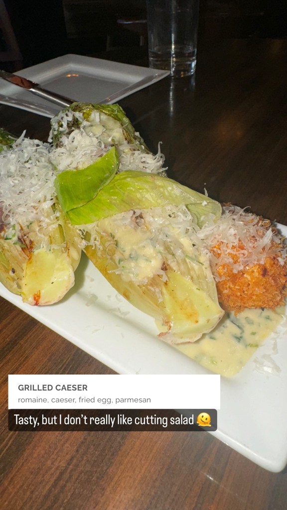
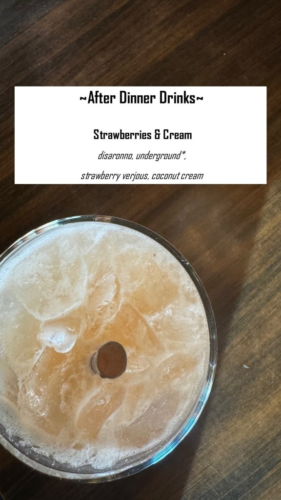
Sego is the fine dining spot in Kanab. It’s “New American” and has a bit of everything to offer. They recommend ordering a few things and sharing with the table. When I went, I was super hungry after hiking Emerald Pools for the second time and got four dishes, including an after dinner drink:


Escobars
The only Mexican restaurant in Kanab is pretty decent; I went here a few times during my stay, returning even though I have a tendency to be very picky when it comes to Mexican food. At Escobars, there was always a wait and one evening I actually found myself sharing a table with another solo diner who strongly recommended Sego! The salsa that comes with the chips is good. The enchiladas and carne asada are good too!
Iron Horse
Iron Horse is a western style BBQ restaurant that I frequented a few times (an observant reader has probably noticed my propensity for being a repeat customer – there aren’t a lot of options in Kanab!). It’s pretty good, but pricey. Get the chili and chopped brisket plate.
Maharaja
Maharaja is an Indian restaurant that shares a space with Sunny Creek Coffee. The food is dank and the very friendly owner can be found manning the cash register most nights. The Chicken Korma with a piece of garlic naan was my go-to.
Snacks & Sweets
Brownbox
Brownbox has the best ice cream in Kanab. The cookies slap too – you can get a cookie ice cream sandwich or even have a deep dish cookie topped with ice cream made fresh to order.
Cave Cafe
Cave Cafe is a little food truck located outside of Moqui Cave that serves sandwiches and fully loaded açaí bowls topped with fresh sliced fruit. No further words needed.
Springdale
By virtue of being the gateway town to Zion, Springdale has some pretty good restaurants.
Lunch & Dinner
Spotted Dog Cafe
Spotted Dog Cafe is one of my favorite restaurants in the area. I went here on three different occasions, each time after frolicking in Zion National Park all day. The bartenders are friendly and were full of suggestions for off the beaten path hikes nearby in Zion. The food is superb and the wines pair well. I had a charcuterie board and mahi-mahi fish special they were offering, the mixed green salad (the citrus vinaigrette is chef’s kiss), beef short ribs, and the grilled New York strip steak.
Snacks & Sweets
Zion Ice Cream
Try the home made juniper ice cream and ask the owner how many iterations it took for them to get it right. It might be some of my favorite ice cream I’ve ever had!
Culture
Best Friends Animal Sanctuary
Best Friends Animal Sanctuary is the nation’s first no-kill shelter founded in 1984. Their mission is to close all kill shelters in the United States by 2025 and end animal homelessness once and for all. I was pleasantly surprised to find that there are a great number of people (including my Airbnb host) who moved to Kanab solely to be in close proximity to volunteer at Best Friends. The place has volunteer opportunities spanning most of the animal kingdom from dogs, cats, horses, bunnies, pigs, parrots, and wild animals. I volunteered doing landscape work in the Angel’s Rest area, mostly pulling weeds and raking. Angel’s Rest is where many of the animals that live onsite in the sanctuary are put to rest. It’s a beautiful area full of wind chimes and panoramic views of Angel Canyon. It felt really good giving back to the community and was one of the most satisfying things I did while in Southern Utah!
Lunch buffet
Best Friends offers an all vegetarian buffet for only $5 per person that is. to. die. for. This is by far the cheapest lunch in the area and all of the entrees were delicious. The peanut butter squares were so good I lost count of how many I ate!
Moqui Cave
Kanab has a rich western film history with many of the great western actors of the 1950 – 1970s passing through town. One common complaint from the actors was that there was no local watering hole and dancehall (it’s Utah!). Enter Moqui Cave! The late Garth and Laura Chamberlain purchased the cave in 1951 and turned it into Southern Utahs first dance hall and bar. A cave inside a bar is super cool, literally as the inside of the cave never rises above 70 degrees, a welcome reprieve from hot Utah summers. Garth Chamberlain was a pretty interesting cat who possessed a keen interest in geology, archaeology, and paleontology; thus there are artifacts from Garth’s travels including rocks, fossils, and other artifacts found all around the world! It’s like $10 to enter and is a fun thing to do on your way back from the national parks. Definitely get an açaí bowl from the Cave Cafe food truck parked out front.

Leave a comment